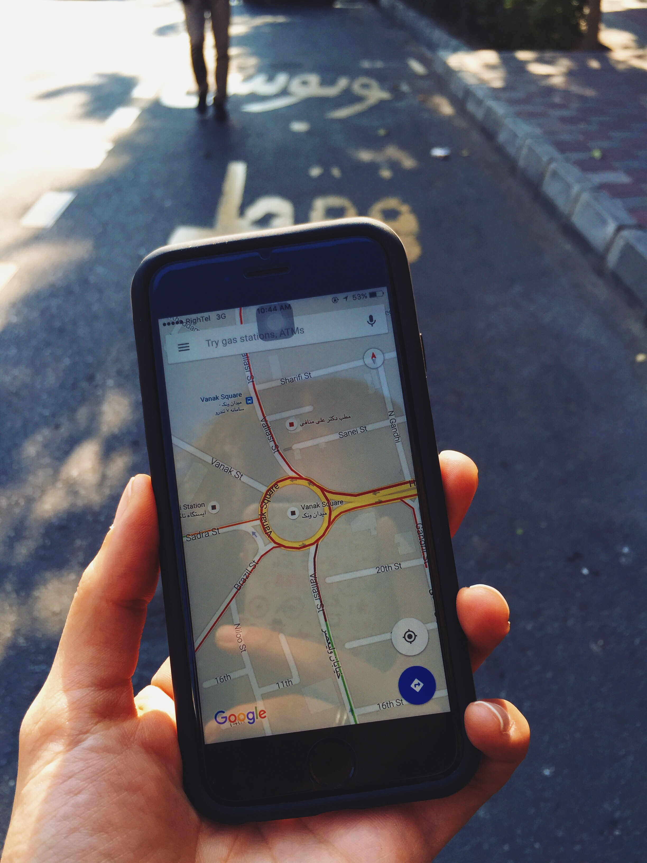
Following an update, Google Maps, the search engine giant’s internally developed mapping platform, has enabled a feature that shows traffic levels in Iran’s capital Tehran and other major cities.
However, when compared with the information provided by the Google Maps, the feature provided by Tehran’s Traffic Control Company shows that the information provided by Google is more precise than the Iranian source, according to Carnet.
Google’s new feature provides precise data on traffic conditions in west and southeast Tehran while traffic data for these areas is unavailable in the Iranian source, due to lack of monitoring equipment in those areas.
Users can access the information provided by Google either online or via the Google Maps app installed on a smartphone.
The reason why the Google data are more reliable is that it collects data via Android phones that have location services turned on and all iPhones that have Google Maps on.
The phones send anonymous bits of data back to Google, which helps the company determine how traffic is flowing. This makes the system by default the most accurate.
Tehran’s Traffic Control Company, on the other hand, collects traffic information using cameras set up around the city, which is why the results are limited and less reliable.
So when people get stuck in traffic, they’re sending Google information alerting people not to go the same way.
Google combines this with historical traffic data it has built up over the years, information from Waze, a crowd-sourced traffic app the company bought in 2013.
As most users turn on their location services by default, information about a location is transferred to Google. Picking up on the speed of users’ movement in a certain area, Google can estimate whether traffic is heavy or running smoothly in a given zone, news website Alef reported.
In most other regions of the world, Google is given the data on public transportation systems—such as arrival and departure times of buses, trains and subways—by the municipalities. Google, in turn makes this information available to citizens.
In Iran, however, due to international sanctions, this data cannot be transferred to Google via official organizations, because of which this service is still missing.
Other major Iranian cities included in the traffic feature update are Isfahan, Mashhad, Tabriz, Shiraz, Kerman, Ahvaz, Bandar Abbas, Yazd and Rasht.
The information on the traffic in Tehran, however, is more comprehensive compared to other cities simply because of the large number of Android phone users in the city.
This information has been made available now only as the use of mobile Internet has expanded in Iran in the past one and a half years. With the increasing penetration of 3G and 4G Internet in Iran, more and more data are provided, which facilitate broad-based traffic estimates.