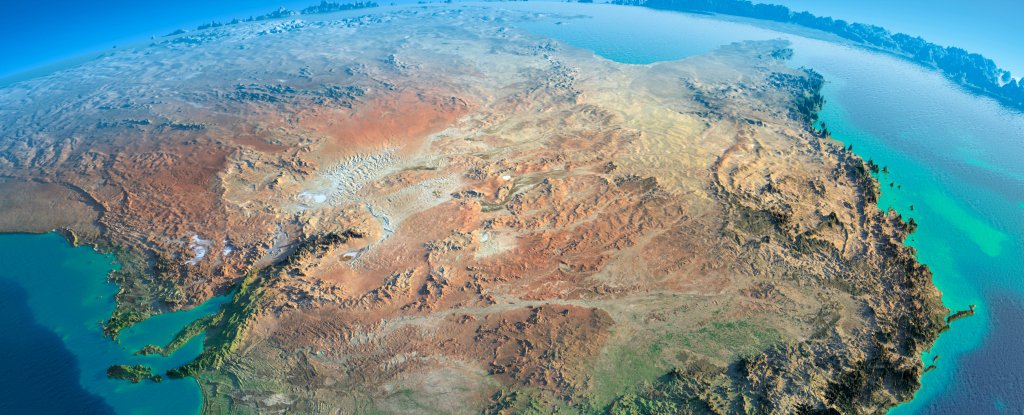
Australia, which rides on the world’s fastest-moving continental tectonic plate, is heading north so quickly that map coordinates are now out by as much as 1.5 meters, say geoscientists.
“There are tweets coming out saying: ‘Hey does that mean my neighbors pool is in my property now?’ Clearly not!” said Dan Jaksa, Australian Datum Manager at Geoscience Australia, a government body.
“What it means is the coordinate of that pool relative to the rest of the world has certainly changed by 1.5 meters,” he said.
Australia’s continental tectonic plate is moving north at a rate of seven centimeters per year, Jaksa said, and mapping systems have not kept pace, Reuters reported.
Maps and the navigation systems, which rely on them, are based on Australia’s position in 1994.
“In the not-too-distant future, we are going to have possibly driverless cars or at least autonomous vehicles where, 1.5 meters, well, you’re in the middle of the road or you’re in another lane,” Jaksa told ABC News.
“So the information needs to be as accurate as the information we are collecting.”
Earthquakes, which are caused by a buildup of tension between tectonic plates, change the structure of landmasses and the sea floor and can shift continents in moments.
Back in 2004, a magnitude 8.1 earthquake occurred in the Pacific Ocean just one day before the Indian Ocean tsunami and it shifted the distance between mainland Australia and Tasmania by millimeters.
After last year’s Nepalese earthquake, the Himalayas actually shrunk by 1.5 meters.
Jaksa and fellow scientists are now recalibrating Australia’s place on the earth’s surface. Their new calculation, called the Geocentric Datum of Australia, will be released in 2017 and plots the continent’s position down to the millimeter.