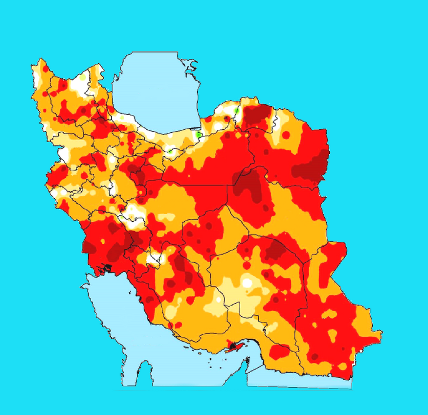
Iran's Forests, Range and Watershed Management Organization has developed an online mapping system featuring drought patterns and hotspots of water crisis. The real-time maps allow the environmental bodies to monitor climatic developments and ranges and forested areas with lower than average precipitation round the clock and come up with more measured responses to natural disasters, such as wildfire and pest infestation, ISNA reported. In addition, Iran Meteorological Organization's seasonal climate report to the government is to expand to also include the state of natural resources. Iran is struggling with an escalating water crisis that has recently reached alarming levels particularly in some southern cities, where tap water has become undrinkable. The new mapping system can be accessed on the website of the National Drought Warning and Monitoring Center.