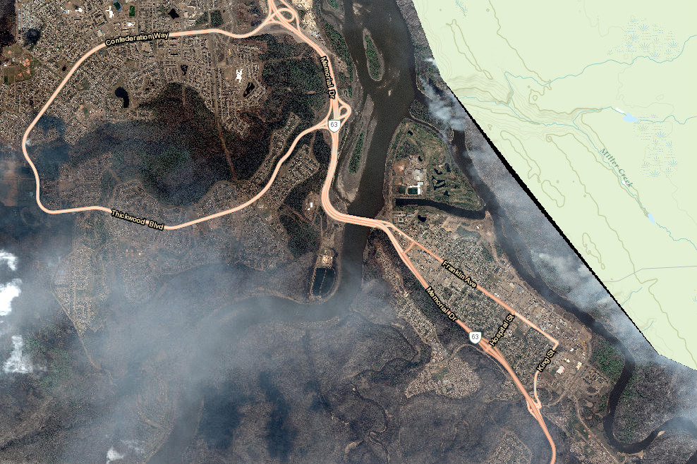
With the Fort McMurray fire zone in Alberta still not safe to enter, many residents who fled to evacuation centers are wondering what’s become of their home. In a move that for evacuees could turn out to be as harrowing as it is helpful, local government officials have launched a website showing recent satellite imagery of the city so worried residents can check on the condition of their property, Digital Trends reported. Danielle Larivee, municipal affairs minister, said the imagery on the website is intended to provide “a high-level satellite overview of the status of the city,” but noted that houses that appear to be intact “should not be considered undamaged.” The minister promised higher-resolution imagery “in the days ahead,” suggesting it could show enough detail to assist property owners with insurance claims, recovery-eligibility funding, and other recovery actions. The content can be viewed by hitting the link at the foot of this page. More than 80,000 people were forced to evacuate Fort McMurray when a huge wildfire swept through the community earlier this month. Estimates suggest around 20%, or roughly 1,600 properties, were destroyed in the disaster, the cause of which is still under investigation.